Mapping Ambient Vulnerabilities
Lenka Hasova
Quantitative Spatial Science group
Department of Geographical Sciences
University of Bristol


Website: ambient-vulnerability.co.uk
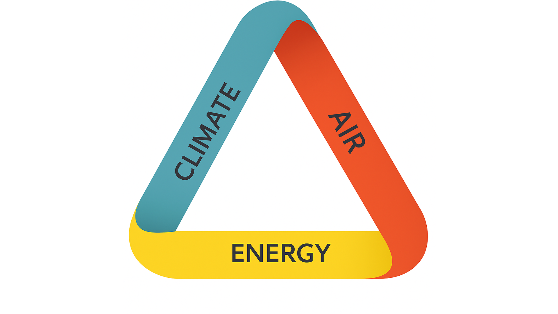
Air Quality vulnerability through peoples lives
3 parts: exposure, sensitivity, and adaptability makes upvulnerability 3 stages: it home, on the move, at work 3 outputs: journal article policy briefing, interactive online outputs
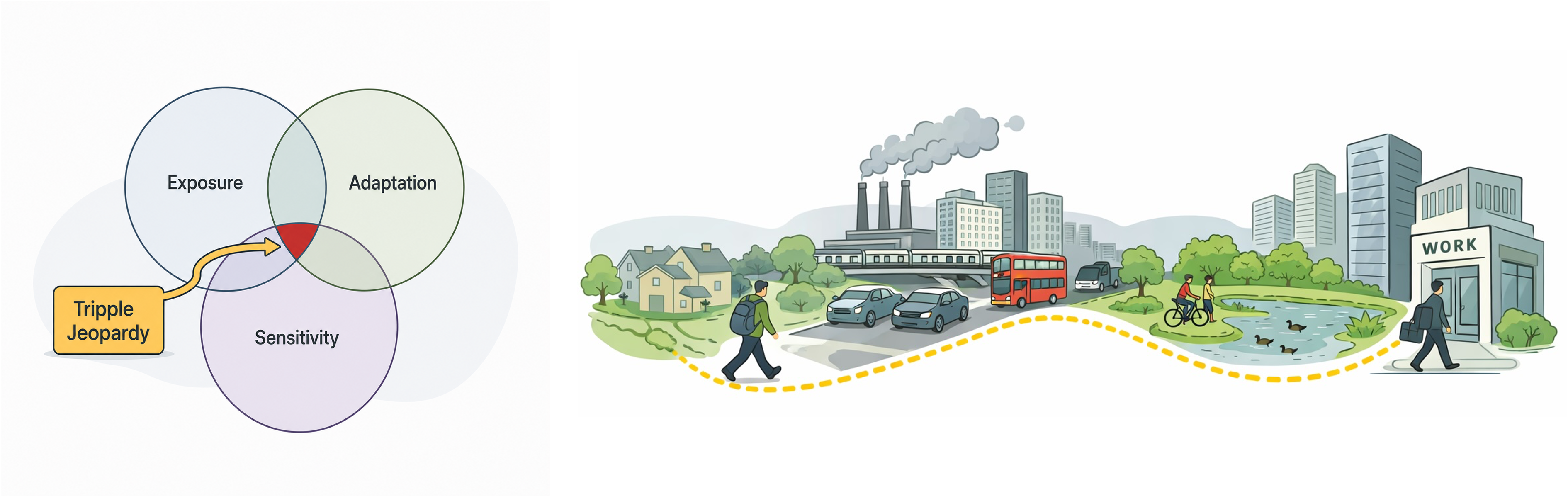
Exposure to air pollution on the move
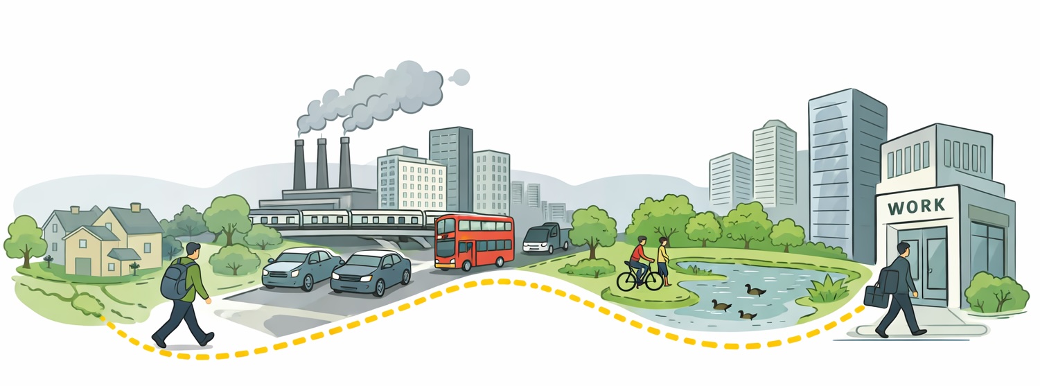
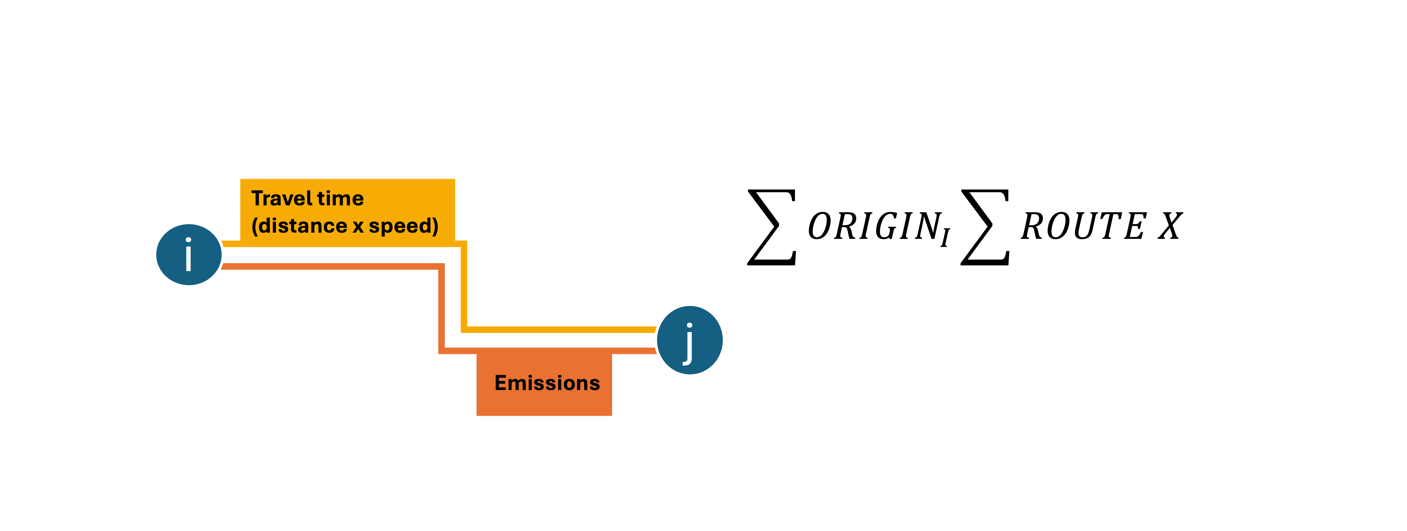
What
Large scale research is limited to fixed locations.
We use national scale simulation of population commutes to understand the dinamic
How
Routing with Pandana is the core, rest is just GIS
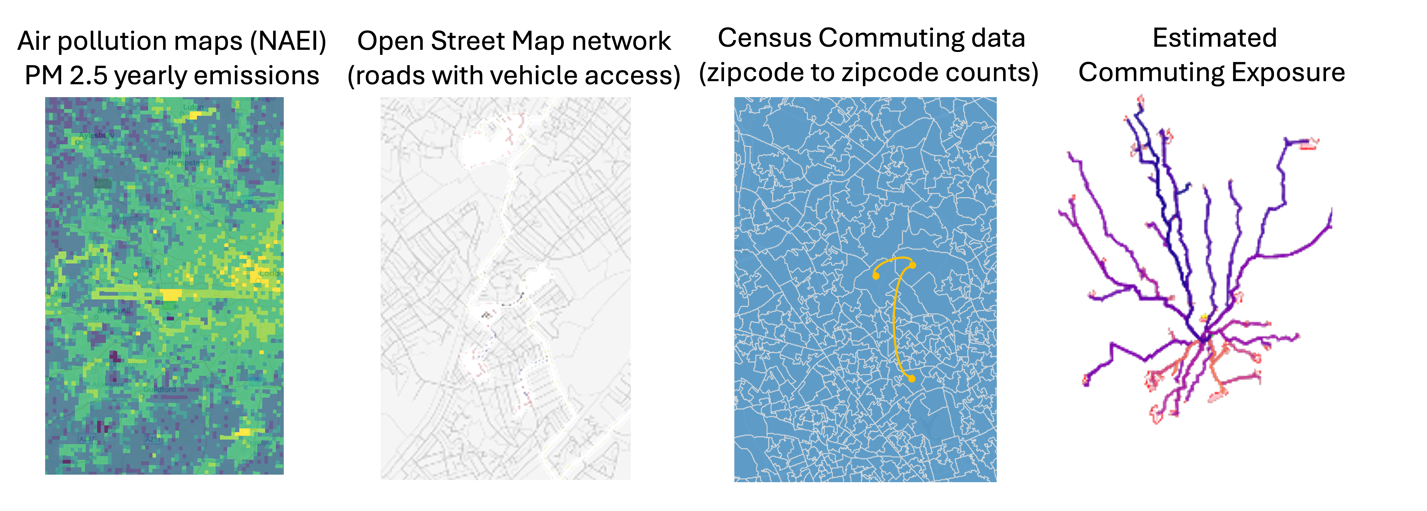
k k k k k
Results
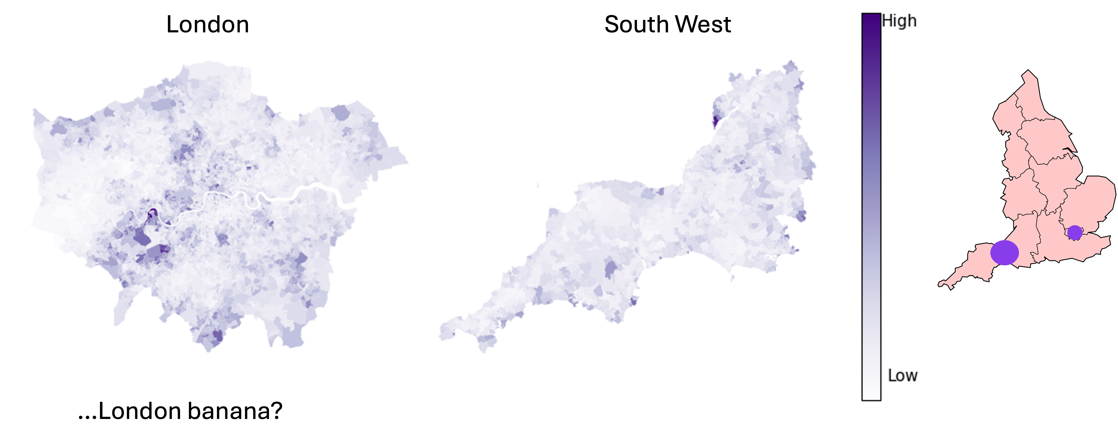
Pm2.5 exposure per journey per commuter within the region
Results
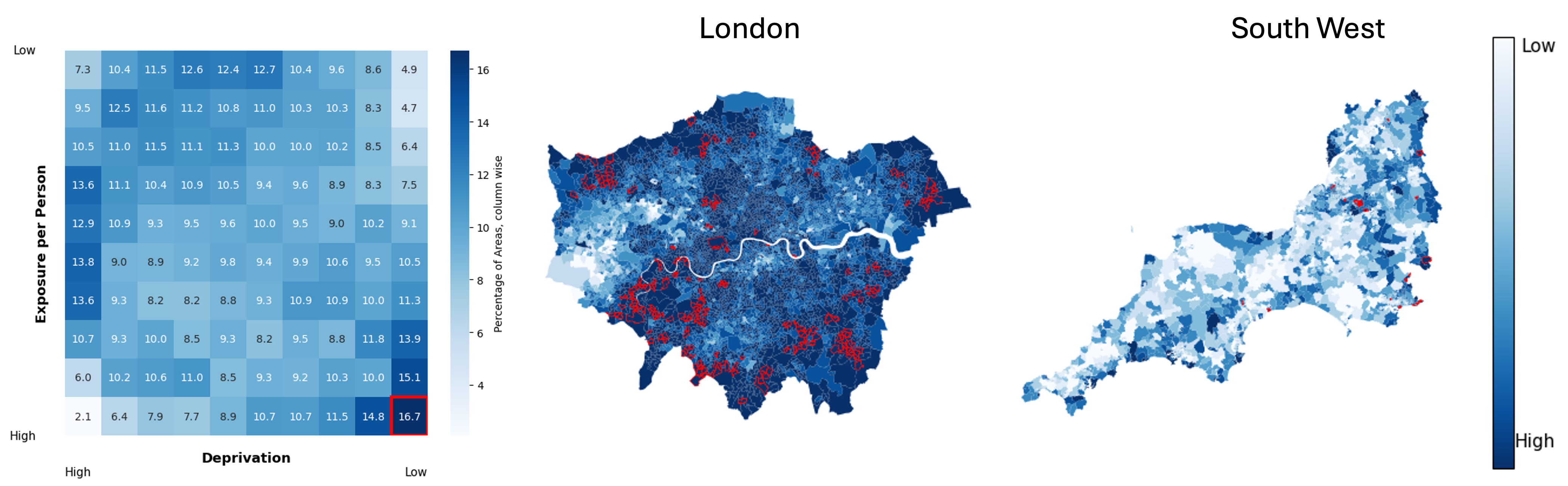
Deprivation deciles paired with the exposure deciles across whole England
Implications
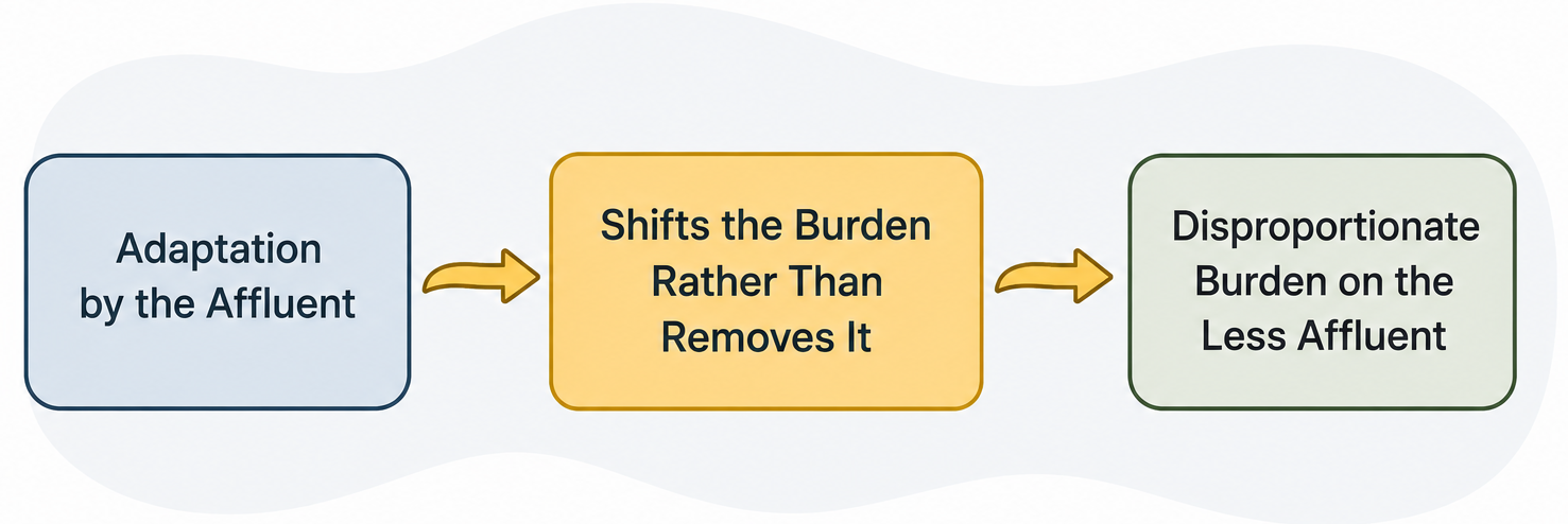
Paired with our previous study
-
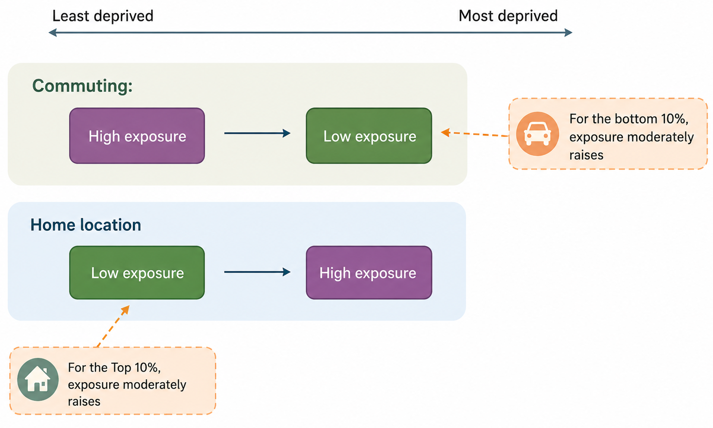
Deprivation is generally concentrated in urban areas.
-
Rural areas are often perceived as cleaner, safer, and more spacious, which can make properties more expensive.
-
Public transport access in rural areas is often limited
-
Choosing a rural location can be viewed as an adaptation strategy, trading accessibility and transport convenience for environmental and residential benefits.
Walking to work, your pm2.5 intake is higher than if commuting in car.
Future steps
- Explore in details the connection betveen high exposure, population socio-economics and the properties of the joureys.
- Relate the findings to teh ideas of distributed justice = what is “fair” and how can policy support that alongisde improving the pollution in the country overall
Thank you!….questions?
Website: ambient-vulnerability.co.uk